Storm Chandra exposed a new and unsettling reality as groundwater flooding pushed Dorset far beyond its familiar winter flood patterns
When Storm Chandra hit Dorset on Tuesday 27th January it released torrents of rain and left much of the county under water. What stood out was not just the volume, but the places affected – locations that do not usually flood. Most North Dorset locals know Hammoon can be a dangerous drive after heavy rainfall, but few expected Sixpenny Handley to become impassable. Each winter brings flooding at familiar pinch points – Caundle Marsh, parts of Blandford Forum, the aptly named Winterbornes – but Storm Chandra pushed far beyond the usual pattern.
Sturminster Newton bridge was impassable. Villages north of Dorchester were significantly flooded – and the water kept rising long after the storm had passed. Groundwater then began seeping from the countryside, seeping through floorboards and turning roads into streams.
A scarier type of flooding
Much of Dorset and parts of Wiltshire are particularly susceptible to groundwater flooding, largely because of the chalk landscape. Chalk acts like a giant sponge: when the water table is saturated the water can rise rapidly. Once underground spaces are full, water is forced upwards – onto roads, into gardens and, in some cases, through floorboards.
This kind of flooding often occurs days or weeks after heavy rain, and conventional flood defences offer little protection. In some cases, spring water must be pumped away from buildings to prevent damage.
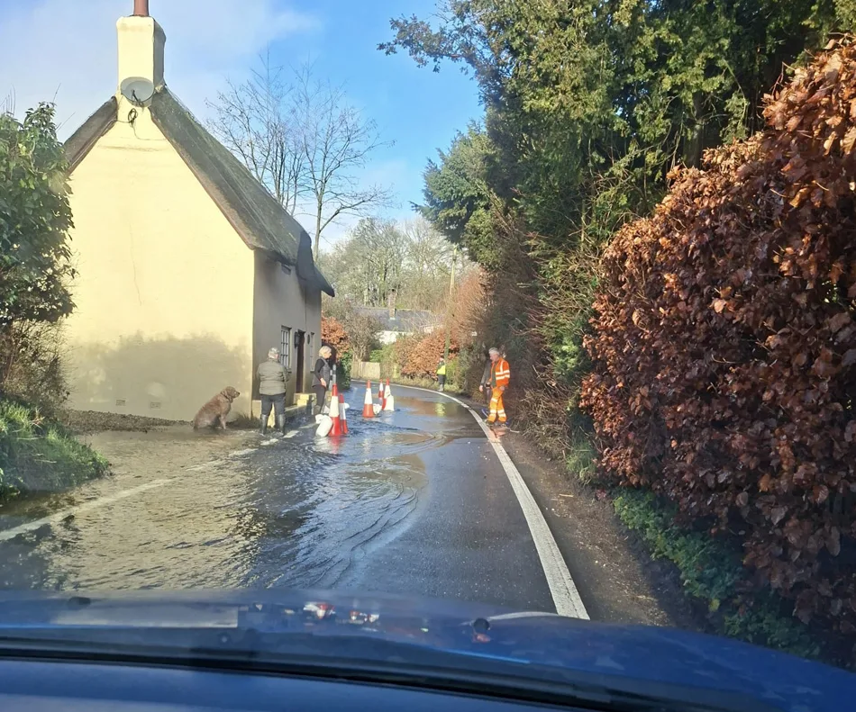
In Tollard Royal, water gushed down the main road, lifting tarmac and placing homes at risk. An ancient roadside cottage built of cob – a traditional West Country mix of mud and straw – was particularly vulnerable to waves created by passing vehicles.
Local resident Joel O’Connor was one of several members of the community who volunteered to support people affected by the floods: ‘We’ve not seen levels of water like this since 2014,’ he says. ‘Usually our gullies are cleared, but they weren’t last year. Once it looked as though flooding was possible, some local residents started trying to clear them but there was so much silt.
‘The groundwater level has risen so high and it’s pushing through peoples’ homes. The storm drains were overwhelmed. It’s scary – we know that when it rains, four or five days afterwards, the water will come up through the ground. So there’s water falling from above and rising from below. Around six properties have pumps in place to minimise the damage.
‘We have a lot of new, deep, potholes and the tarmac is beginning to peel away.
‘What’s lovely is the beautiful way the community has pulled together over this, helping those affected by the floods.’
During and following Storm Chandra, hundreds of workers from Dorset Council were busy closing roads, clearing blockages, and dealing with the general disruption.
Is it the drains?
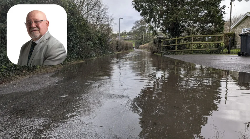
Dorset Council’s cabinet member for place, Councillor Jon Andrews, rejected claims that blocked drains or new housing were the primary cause of the flooding:
‘We understand the frustration,’ he wrote on Dorset Council social media. ‘When water sits outside your home or on the roads, it’s completely natural to think the drains must be blocked. And yes, blocked drains can make local problems worse – we’re not denying that.
‘But the main issue isn’t drain clearance. Highways drains are designed to deal with rainwater that falls directly onto the road. They aren’t built to cope when rivers spill over, fields release huge amounts of water or groundwater forces its way up from below. When rivers and groundwater rise that quickly, the pipes beneath road drains [storm drain grates] become completely full, so even a clear drain simply has nowhere to send the water.’ He added that groundwater flooding is particularly difficult to manage, warning that measures such as sandbags are ineffective when water is rising from beneath properties.
He also denied that new developments increase flooding risk: ‘Some people have claimed that new housing developments are making this worse. It’s worth noting that national planning rules already require new homes to be safe for their lifetime and not increase flood risk for existing communities. That remains the case.’
However, a recent government review* changes that picture. It concluded that groundwater flood risk is not being adequately or consistently considered in planning decisions – particularly when combined with future climate scenarios. The review also found there is limited guidance on how to mitigate development impacts where groundwater interacts with other forms of flooding, suggesting current planning frameworks do not fully take this risk into account.
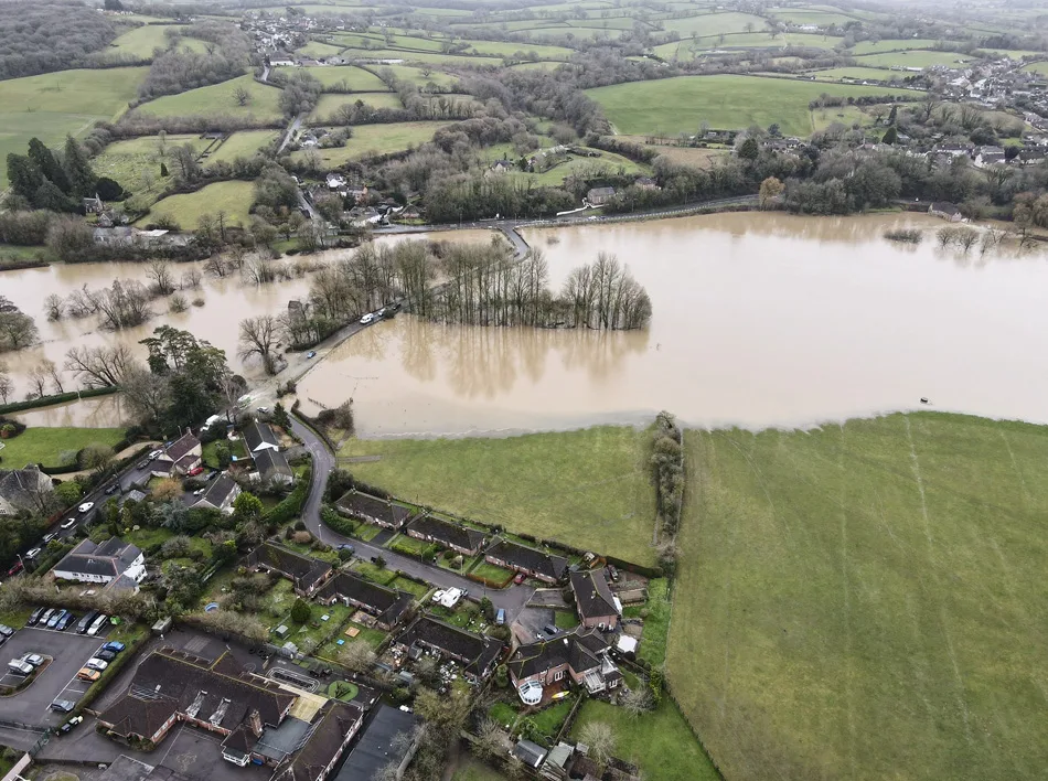
Image: Sturminster Newton Town Council.
Open the floodgates
It is very rare to see Sturminster Newton’s bridge closed. The town council’s longstanding grounds manager, Adam Dodson, spoke to The BV about the floods. ‘The last time we experienced this type of flooding was 24th December 2013,’ he said. ‘That was a record, as far as I’m aware. We do experience floods most years – but not to this extent.
‘There could be many reasons – ditches not being maintained;
big housing developments putting increased pressure on rivers – the water has to go somewhere.
‘Most new developments include SUDS (Sustainable drainage systems) to manage water run-off, but those are site-specific. The water table, on the other hand, is a consistent source of water to rivers. Increased building will affect how that water flows into the river. It could increase the amount flowing into it, or back the water up and increase flooding elsewhere.
‘In Stur we had comments made regarding the sluice gates not being opened at Sturminster Mill, and that this had affected the floods. This is not the case. The sluice gates at the mill are used to control the water level to run the mill: they are not a flood defence. They can be opened to allow water through, but as Fiddleford Mill gates are permanently shut, this can cause backing up issues and increase flooding downstream. And then if the gates are opened and the water level drops too low behind the mill, this can cause riverbanks to collapse. It can also affect fish stocks. So it is a fine balance and a lot of expert knowledge is required.
‘The town council sought the advice of a structural engineer, the miller and a millwright. They unanimously concluded that the sluice gates were not to be used as flood defence. The structural engineer advised that if the sluice gates were to be opened in the event of a flood, this could cause severe structural damage. When closed, the sluice gates provide a solid structure. If opened (during flooding), there is a significant risk that the entire structure would be weakened. Drain clearances and ditch maintenance would certainly help, but could not eliminate the risk of severe flooding. The weather cycles have changed and we experience more wet rather than cold winters now.’
What is clear from the volume of rain and warmer winters is that climate change is already shaping how and where flooding occurs. Once the water recedes, communities and authorities will need to assess how Dorset can better manage floodwater in a county already vulnerable to groundwater rise.
This is not an abstract environmental issue. It threatens homes, livelihoods and infrastructure, and will require innovative engineering, smarter land use and more robust planning rules as we adapt to a wetter, more volatile future.
* Future of the subsurface: urban water management in the UK (annex), Government Office for Science 2024
Thank you for such a well worded article. You have expressed a clear understanding of the problems faced by Dorset in the future due to the heavier rainfall and extreme weather due to global climate change.