Farming is changing fast. Instead of checking their fields by foot, more and more farmers are turning to views from space to keep an eye on their crops. What used to be a tool for scientists and space agencies is now something growers use every day.
This matters because satellite imagery supports modern agriculture by giving farmers a way to watch their crops over large areas and spot problems early. With this information, they can use water, fertilizers, and other resources more wisely, and adjust quickly to weather or environmental shifts. Combining satellite data with what they see on the ground helps farmers make smarter choices that are better for both their yields and the environment.
Eyes in the Sky, Decisions on the Ground
When satellite data arrives, the most valuable moments begin. These high-resolution images and measurements inform decisions that directly affect yield, cost, and environmental impact. Across the farming calendar, Earth observation helps farmers respond with precision and speed.
Instead of relying on routine schedules or visual inspection, farmers today can use satellite-based insights to fine-tune how and where they irrigate. By analyzing vegetation and moisture indices like NDVI and SMI, which reveal subtle changes in crop health and soil moisture, they can pinpoint exactly which areas need attention. This smarter, data-driven approach reduces unnecessary water use and ensures plants aren’t harmed by inconsistent watering, leading to healthier crops and more sustainable farming practices.
Fertilization also benefits from this targeted approach. Satellite images of agricultural land reveal nutrient deficiencies before they become visible to the naked eye. Farmers can then apply fertilizer variably across the field, reducing waste and avoiding environmental runoff. These decisions not only lower costs but also support healthier soils over time.
Pest and disease detection has become more proactive as well. When plants are under stress from pests or pathogens, their reflectance patterns change slightly. Satellite imagery analysis can help detect these signals before any visible damage occurs. This allows farmers to take action earlier, often before outbreaks spread across an entire field.
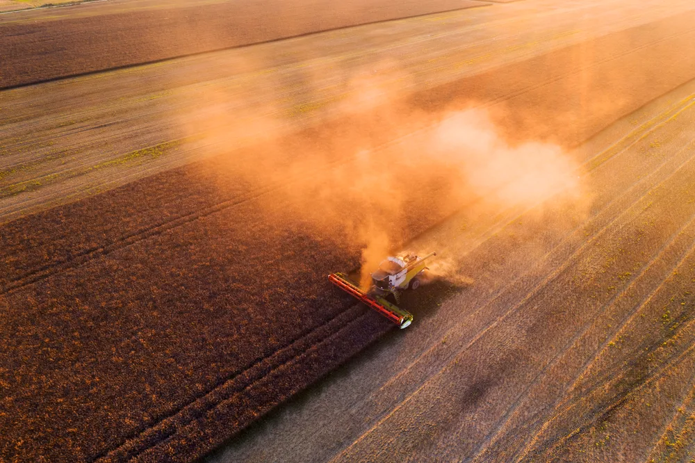
Planning for harvest is another area where satellite data offers clear advantages. By analyzing crop development through satellite imaging in agriculture, producers can forecast maturity and estimate yield potential. With this information, they can better coordinate labor, storage, and transportation, leading to less waste and higher efficiency.
One of the proven examples of satellite imagery efficiency is the European Commission’s use of Sentinel‑1 and Sentinel‑2 data to map crop types across the entire EU. In 2022 this model produced a continental crop map at 10‑meter resolution, identifying 19 different crop types with an overall accuracy of nearly 80 percent. This work combined radar and optical imagery with ground survey data to produce actionable crop monitoring insights.
From Observation to Automation
Earth observation does more than improve human decision-making. It also feeds directly into the automation tools that are becoming increasingly common in agriculture. Tractors, drones, and sprayers equipped with GPS and geospatial data can now operate with extreme precision, often without constant manual input.
These machines rely on data such as precision agriculture satellite imagery to carry out specific tasks. For example, autonomous tractors can follow optimized paths, planting or applying chemicals based on real-time field conditions. This method reduces overlap, saves fuel, and ensures inputs are used efficiently.
Perhaps even more transformative is the shift in mindset that Earth observation enables. Farmers no longer view a field as one uniform space. Instead, they see it as a collection of microzones, each with its own needs and responses. Managing these zones individually, based on data collected from space, leads to healthier crops and better yields.
The long-term benefits are just as significant. By looking at historical satellite records, farmers can identify trends across seasons and years. They can see which parts of their land perform consistently and which areas may need different management. This deeper understanding allows for better planning, smarter crop selection, and stronger resilience to climate change.
Importantly, these technologies are becoming more accessible. Thanks to falling costs and open data policies, Earth observation is no longer limited to large farms. Smallholders in developing countries are beginning to use satellite data for agriculture to improve productivity and reduce risk. In regions like Sub-Saharan Africa and South Asia, projects are helping local farmers use satellite data to make informed decisions about planting, irrigation, and harvesting.
A New Chapter for Agriculture
Farming has always required a sharp eye and careful observation. What is changing is the scale and speed at which farmers can now gather and interpret information. Earth observation extends the reach of that traditional knowledge, offering insights that were previously out of view.
In the face of global challenges such as climate volatility, food insecurity, and resource scarcity, agriculture needs every advantage it can get. Satellite technology is now one of those advantages. It provides information that helps farmers act quickly, use fewer resources, and make better choices.
This shift does not mean replacing boots on the ground. Instead, it means enhancing those efforts with a broader perspective. With each satellite pass, a more detailed picture of the land emerges. And with that, a new kind of agriculture takes shape, one that is more intelligent, more efficient, and more in tune with the planet.